
New Hampshire Way contains affiliate links. If you make a purchase through these links, we will earn a commission at no extra cost to you. Thanks!
The NH 48 is New Hampshire’s favorite hiking challenge: climbing all 48 4000 footers. 48 of New Hampshire’s mountains are at a higher elevation than 4,000 feet (1219 meters), and those who have succeeded climbing all of them are in a special club.
New Hampshire’s 48 4000-footers are recognized by the Appalachian Mountain Club, and the rules to the challenge are simple: climb on foot to and from the summit of each peak. You can count a multiple peaks in a single trip. And it’s all on the honor system.
When you complete the 48, you can apply for recognition with the AMC and get a hiker achievement patch and an invite to the annual awards dinner.
Here is the complete list of the NH 48, along with difficulty. (Please keep in mind that “easy” is relative when you’re talking about 4000 footers.) And keep reading for our guide to successfully completing the NH 48 and beyond!
This post was most recently updated in May 2024.
Table of Contents

NH 48 List: 4000 Footers of NH
| Washington | 6,288 | Difficult |
| Adams | 5,744 | Difficult |
| Jefferson | 5,712 | Difficult |
| Monroe | 5,384 | Difficult |
| Madison | 5,367 | Intermediate |
| Lafayette | 5,249 | Difficult |
| Lincoln | 5,089 | Difficult |
| South Twin | 4,902 | Difficult |
| Carter Dome | 4,832 | Difficult |
| Moosilauke | 4,802 | Intermediate |
| Eisenhower | 4,780 | Difficult |
| North Twin | 4,761 | Difficult |
| Carrigain | 4,700 | Intermediate |
| Bond | 4,698 | Difficult |
| Middle Carter | 4,610 | Difficult |
| West Bond | 4,540 | Difficult |
| Garfield | 4,500 | Intermediate |
| Liberty | 4,459 | Intermediate |
| South Carter | 4,430 | Difficult |
| Wildcat A | 4,422 | Intermediate |
| Hancock | 4,420 | Intermediate |
| South Kinsman | 4,358 | Difficult |
| Field | 4,340 | Easy |
| Osceola | 4,340 | Intermediate |
| Flume | 4,328 | Intermediate |
| South Hancock | 4,319 | Intermediate |
| Pierce | 4,310 | Easy |
| North Kinsman | 4,293 | Difficult |
| Willey | 4,285 | Intermediate |
| Bondcliff | 4,285 | Difficult |
| Zealand | 4,260 | Intermediate |
| North Tripyramid | 4,140 | Difficult |
| Cabot | 4,170 | Easy |
| East Osceola | 4,156 | Easy |
| Middle Tripyramid | 4,140 | Difficult |
| Cannon | 4,100 | Easy |
| Wildcat D | 4,070 | Intermediate |
| Hale | 4,054 | Easy |
| Jackson | 4,052 | Easy |
| Tom | 4,051 | Intermediate |
| Moriah | 4,049 | Intermediate |
| Passaconaway | 4,043 | Easy |
| Owl’s Head | 4,025 | Difficult |
| Galehead | 4,024 | Difficult |
| Whiteface | 4,020 | Easy |
| Waumbek | 4,006 | Easy |
| Isolation | 4,004 | Difficult |
| Tecumseh | 4,003 | Easy |
(You may be wondering why a few mountains are missing here — namely, Mount Clay, Mount Guyot, and the south peak of Mount Moosilauke. That’s because to qualify for the list, a peak must have an elevation gain of 200 feet beyond any ridge connecting it to its neighbor.)
NH 48 FAQ
Some of the 4000 footers with the best views include Mount Adams, Bondcliff, Mount Pierce, and Cannon Mountain.
Mount Pierce is a great mountain to start your NH 48 challenge. Moosilauke, Osceola, and Tecumseh are nice choices, too.
Good news: there’s no time limit. Though some people who attempted the White Mountain Direttissima completed all 48 in 10 days!
The New England 67, 52 with a View, and Terrifying 25 are a few of the many mountain-climbing challenges beyond the NH 48!

How to Accomplish the NH 48
Hiking the NH 48 is not something that you do overnight. Think of it as a marathon, not a sprint! Here are some things you should do:
Get a NH Hike Safe card. Probably the most important thing you can do. This card will insure you if you need to be rescued at any point, as New Hampshire charges for rescues (more on that in the safety section below).
Get the AMC White Mountain Guide. This guidebook is the best of the best — you get trail descriptions, time estimates, and maps.
Keep an eye on the weather and trail conditions. Be especially cautious of the weather, as it can change in an instant. While rain isn’t a dealbreaker, thunderstorms are.
Hike multiple mountains in a single trip. Most NH 48ers bag a few peaks in a single trip. Wiley, Ford, and Tom are often done together, as are North and South Kinsman; Lafayette and Lincoln; Pierce and Eisenhower; Bondcliff, Bond, and West Bond; Wildcat A and D; Adams and Madison; and Monroe and Washington.
Go for weekend trips as well as day trips. The easiest way to add three to five peaks to your tally is to head up for the weekend. We at New Hampshire Way are big fans of hiking on September weekends, which are beautiful and uncrowded.
Become a regular at your favorite post-hike spots. We love New Hampshire’s breweries for this — and Rek-Lis in Bethlehem draws a fun crowd of hikers.
Network with fellow hikers. The Hike the 4,000 Footers of New Hampshire Facebook group is a very active group of 70,000+ hikers, many of whom are looking for hiking buddies.
Get recognized by the AMC folks. You don’t have to apply, but why not? You’re part of the 4000 footer club now! You could even attend their awards ceremony in Exeter.
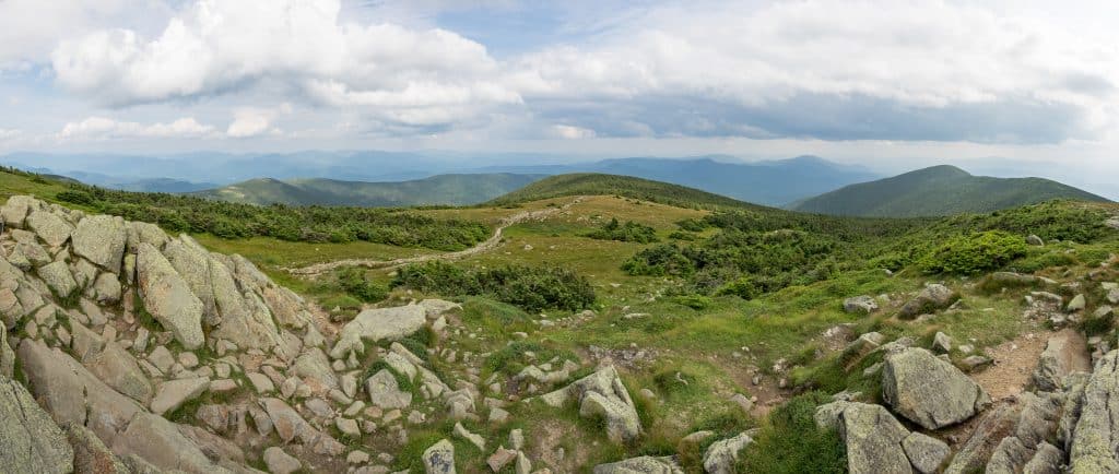
4000 Footers with the Best Views
Which of these mountains have the best views? It’s all relative, of course, but some of the mountains have something a bit more special.
Cannon Mountain has incredible views across Franconia Ridge, and you can even see to Canada on a clear day.
Mount Adams has 360-degree views of the Presidential Range, plus similar views to Mount Washington without all the STUFF at the Mount Washington summit.
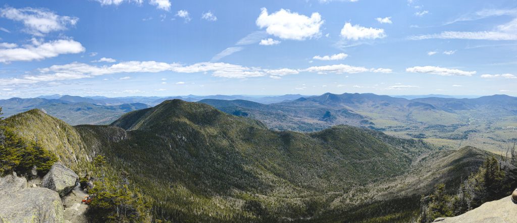
The Bonds — Bondcliff, Mount Bond, and West Bond — are among the toughest and remote peaks in the White Mountain National Forest, rewarding you with stunning views from their summits. Bondcliff has the best view of all, with a rocky platform that makes a great photo spot if you’re hiking with a friend (or tripod!).
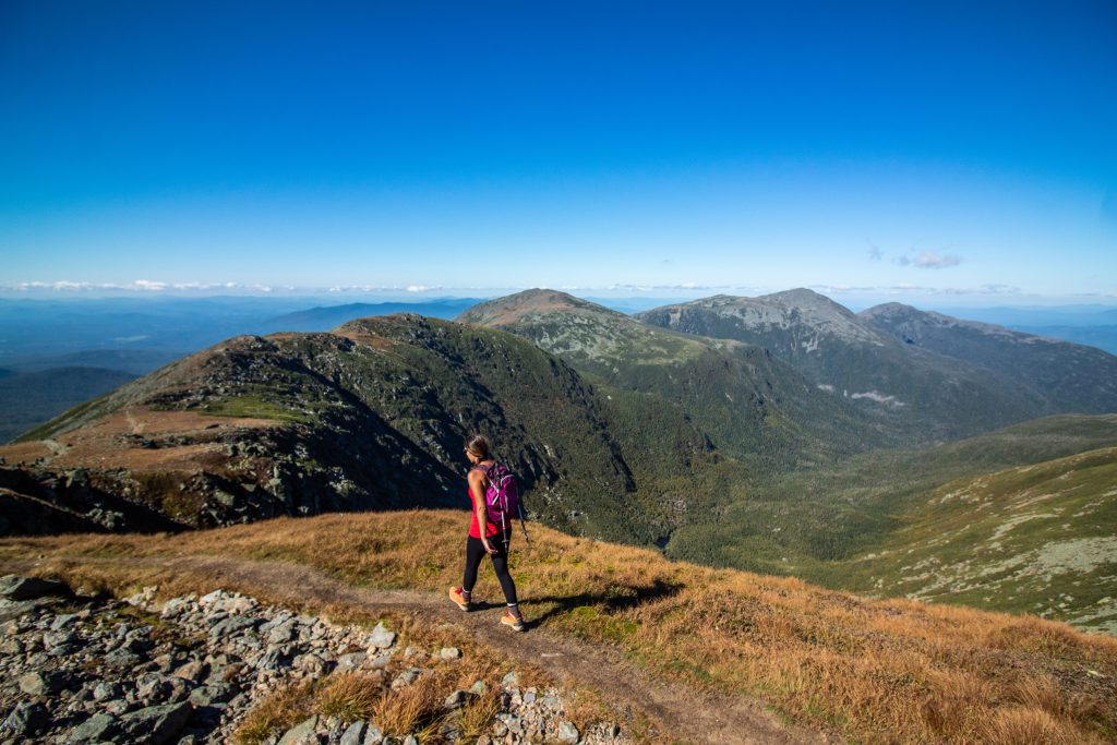
Mount Pierce arguably has the best view of the easier peaks to climb, with several rolling mountains leading up to Mount Washington.
Mount Moosilauke is another easy peak to climb with gorgeous panoramic views over the surrounding landscape.
Good Mountains for Starting the NH 48
You don’t necessarily need to start with the shortest mountains — though many hikers do start with Mount Tecumseh, the shortest of the 4000 footers. Tecumseh is a solid choice, and easily accessible in the Waterville Valley, though there are limited views at the summit.
Overall, many hikers recommend starting with a few easy hikes with nice views — something to reward you for your work and encourage you to keep going until you’re used to hiking the Whites on a regular basis.
Mount Pierce is frequently recommended as one of the best hikes to start with, thanks to an easy hike from Crawford Notch and stunning views up toward Mount Washington at the summit. Probably the best effort-to-reward ratio in the White Mountains!
Some easier 4000-footers with good views include Mount Moosilauke, Mount Tom, Mount Jackson, and Mount Osceola. Hit those up early in your journey.

Good Mountains for Finishing the NH 48
Should you end on Mount Washington, as it’s the highest peak? Some people do, but many choose to hike Mount Washington and Mount Monroe in tandem earlier in their journey.
If you’re looking to work up to the most challenging climbs, save Mount Adams and Mount Madison for last. Other challenging peaks are Mount Isolation and Mount Lafayette, good hikes for after you’ve developed a higher level of fitness.
But if you’re finishing in the summer and want to celebrate with your loved ones, consider finishing with Cannon Mountain or Wildcat D. These two mountains have access via tram during the summer months, so the non-hikers can come up the easy way and join you at the finish line!
You can do the same with Mount Washington, having your loved ones come up via the Mount Washington Cog Railway or the Mount Washington Auto Road.

NH 48 in Winter and Beyond
Many peakbaggers who complete the NH 48 set their sights on a new goal: hiking the NH 48 in winter. The rules of the original 48 apply, only the trips must be done between the official winter solstice and spring equinox. Winter conditions can be rough in the White Mountains, so conquering all 48 is quite the accomplishment.
Both skis and snowshoes are permitted during winter climbs.
Hiking safety is especially important during the winter season. Don’t attempt any winter climbs unless you have the proper gear and clothing.
Next up is the Four-Season NH 48. The rules are the same as the NH 48, only each peak must be climbed in each of the four seasons, according to the date and time of the solstice and equinox. This totals 192 summits.
The Appalachian Mountain Club requires 48 hours of trail work to be performed to earn the patch. You can find out more information on that here.
And then there’s The Grid. Invented by Ed Hawkins and designed for New Hampshire residents, the Grid involves climbing each of the NH 48 in all 12 months of the year. 576 peaks in total.
The Grid, of course, is more of a lifetime goal than something you get done quickly. As of May 2024, 176 people have completed the Grid. Here’s the full list. If you run into any of the finishers, buy them a drink — they’ve got stories!
And then there’s Sue Johnston, perhaps the most badass hiker of all, who completed the Grid within a calendar year!
Finally, there’s the White Mountains Direttissima. A direttissima is a single trail that hits every single mountain in a range, and while there’s no official route, any continuous hike that includes all 48 summits can be considered a White Mountains direttissima. More information on that here.
Other Mountain Challenges in NH
The NH 48 is just one of several mountain challenges in New Hampshire and New England. Here are some of them:
52 with a View (52 WAV) is a challenge of climbing 52 of New Hampshire’s peaks that are under 4000 feet but each have gorgeous views. Some of the peaks include Mount Willard, Mount Monadnock, and Mount Chochorua.
The Terrifying 25 is a challenge including 25 of the most intimidating trails to hike in New Hampshire, including the King Ravine Trail, Great Gulf Trail, and the ladder route of the Mount Morgan Trail (eek!). Official site here.
The New England 67, also known as the New England Four Thousand Footers, includes the full NH 48 plus an additional five peaks in Vermont and 14 in Maine.
The New England Hundred Highest, awarded by the Appalachian Mountain Club, includes the 100 highest peaks in New England. So it’s basically the New England 67 plus an additional 33 peaks, including Mount Sandwich, the Bulge, Mount Nancy, and several others in New Hampshire.
The Northeast 111, awarded by the Appalachian Mountain Club, includes the New England 67 plus an additional 44 peaks in the Adirondacks and Catskills in New York State.

Hiking Safety in New Hampshire
Surprise — New Hampshire is a state where you can be charged for your own rescue if you are found to be negligent. Unfortunately this happens more often than you think. While needing to be rescued is bad enough, having to pay for it adds insult to injury!
Fortunately, there are ways to stay safe and avoid this. Here are my safety tips for hiking in New Hampshire:
Get the New Hampshire Hike Safe card before you set out on your hike. These cost $25 per person, or $35 per family. This supports the NH search and rescue efforts, and means you will not need to pay for your rescue. You can buy your card here.
Don’t rely on your phone for navigation. You don’t always get accurate GPS with your phone in the White Mountains. Be sure to bring a paper map with you, and make sure you know how to read it. NHW recommends the Map Adventures waterproof White Mountains trail map.
Stay hydrated and bring enough water for your hike: two liters per person per day. In an emergency, you can refill from a natural water source as long as you have a way to purify it. This may be a Lifestraw water bottle, a Steri-Pen, water purification tablets, or a small filter pump.
Make sure someone knows where you’re hiking each day. Check in with them before you begin your hike, make sure they know where you’ll be hiking that day, and let them know you’re safe when you’ve finished. Many B&Bs and guesthouses in New Hampshire encourage you to tell them your plans before you head out.
Check the weather. New Hampshire can be prone to afternoon thunderstorms in the late summer, so it’s always best to head out on the trail early.
Layer up! Much of the hiking in New Hampshire involves high, exposed sections, and parts above treeline. For a state with famously changeable weather, it’s important you have adequate gear in your pack. Pack base layers, mid-layers of fleece or down, and a waterproof shell for rain. And make sure your hiking shoes are well broken-in before attempting any peaks.
More on Hiking:
More on the White Mountains:
- A Guide to Driving the Kancamagus Highway
- 27 Epic Things to Do in Lincoln, NH
- A Guide to Glen Ellis Falls, NH
- A Guide to the Mount Washington Cog Railway
- Hiking the Appalachian Trail in New Hampshire
- Snow and Ice Climbing in the White Mountains, NH
- 31 Fun Things to Do in North Conway
- 12 Best Restaurants in North Conway
- Riding The Conway Scenic Railroad
- Tips for Driving The Mount Washington Auto Road
- 23 Fun Things To Do In Littleton, NH
- 16 Best Things To Do in Jackson, NH
- 30 Unforgettable Things To Do In The White Mountains, NH
Best of New Hampshire:
- 50+ Best Things to Do in New Hampshire
- 13 Best Beaches in New Hampshire
- New Hampshire’s Best Breweries
- New Hampshire Fall Foliage Guide
- 30 Unforgettable Things To Do In The White Mountains, NH

Have you attempted the NH 48? Share your tips!
Regular New Hampshire hiker here… the NH Hike Safe card does not necessarily mean you won’t be charged. If you are found to be completely unprepared and/or that you took wild, highly unnecessary risks, they may still charge you. It says right on their site “An individual may still be liable for response expenses if the actions that created the need for the emergency response meet criteria set forth by legislation” and provides a link from there with more info. Just an FYI 🙂 otherwise a great post with some good tips.
Thank you, I’ll amend that to make it clearer!