
New Hampshire Way contains affiliate links. If you make a purchase through these links, we will earn a commission at no extra cost to you. Thanks!
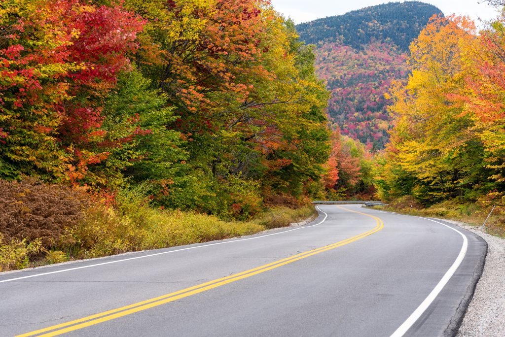
Driving the Kancamagus Highway is one of the absolute best things to do in New Hampshire! The Kanc, as locals call it, is a twisty, forested, mountainous highway that takes you through the White Mountain National Forest.
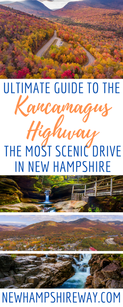
If you’re looking for scenic drives in New Hampshire, we have quite a few, but the Kancamagus Highway, also called the Kancamagus Scenic Byway, might be the most scenic drive of all. And it may be the best place in the world to enjoy New England fall foliage!
This two-lane highway take you up to 2,855 feet (870 meters) at its highest point on Kancamagus Pass, curving between mountains and along the Swift River. The starting points are in Lincoln and Conway, and you can go in either direction.
What makes the Kanc great is that it’s for everyone. Whether you’re a hardcore backcountry camper, a city couple that doesn’t spend much time in the country, or a family with two toddlers, the Kanc has something for everyone.
And while it may be a narrow, curvy highway, the Kancamagus Highway is very easy driving. The road is in excellent condition and while there are a few hairpin turns, you don’t need to be an especially skilled driver in order to do it well.
Let’s dig into what makes this New Hampshire road trip so fun.
This post was most recently updated in May 2024.
Table of Contents

Kancamagus Highway FAQ
The Kancamagus Highway is 56.39 miles long (90 km).
If you don’t stop, it should take you just under an hour to drive the Kancamagus Highway, but we recommend stopping frequently and allotting half a day, or more if you want to do long hikes.
The Kancamagus Highway begins in Lincoln, NH, and ends in Conway, NH (or vice versa).
There are no gas stations, convenience stores, food stores, or hotels anywhere along the Kancamagus Highway. Stock up before you go.
The highway is named after Kancamagus, the Fearless One, the final Sagamore of the Pennacook people and ruler of what is now New Hampshire.
Kancamagus is technically pronounced kan-ka-MAW-guss, but plenty of people pronounce it kan-ka-MAH-guss.
The Kancamagus Highway is free to drive, but the cost of parking in the White Mountain National Forest is $5 per day.
Best Time to Drive the Kancamagus Highway
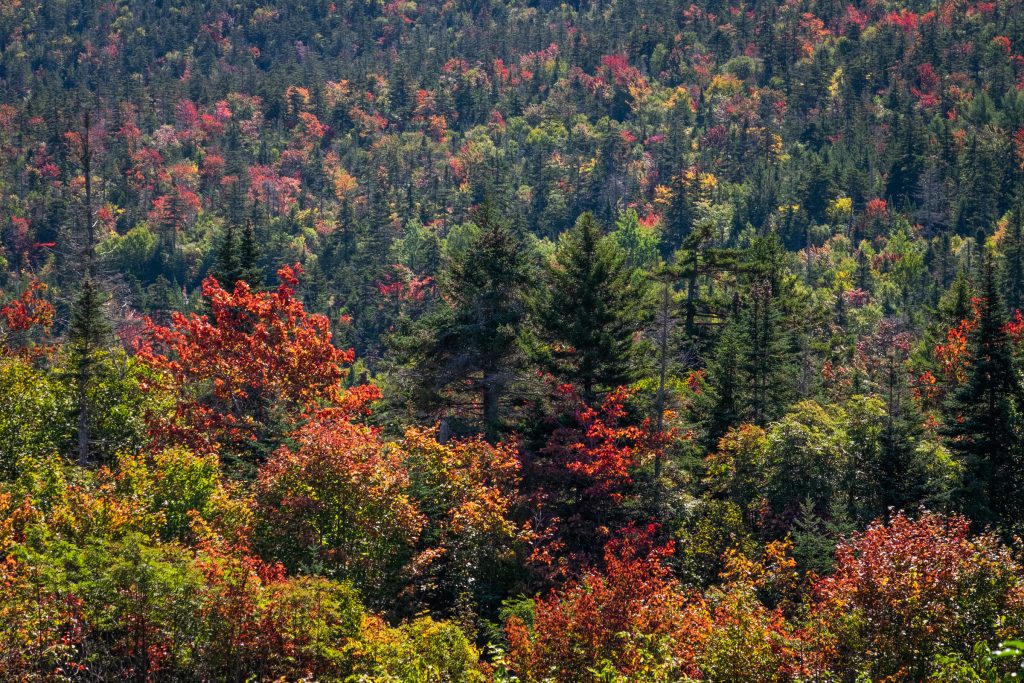
Type “Kancamagus Scenic Byway” into Google Images and most of the photos will be explosions of red, orange, and gold. Yes, fall is the most beautiful time of year here, and you can’t beat driving the Kanc during peak foliage.
When is peak foliage in the White Mountains? Usually the best color is in early October, sometimes from late September into mid-October. Most years you’ll see sneaky bursts of color beginning to appear around September 15-20.
Peak foliage is as crowded as the White Mountains gets, especially over Columbus Day weekend, and accommodation can be expensive at this time.
But fall isn’t the only season here. We love driving the Kanc during the summer months, when it’s so nice cooling off in the rivers, and winter is great for cross-country skiing and snowshoeing.
If you’re visiting New Hampshire from far away, we recommend driving the Kanc during peak foliage. If you’re coming from afar, you deserve to see this American scenic byway at its absolute best!
But if you’re a New Englander and used to brilliant fall foliage every year, you may enjoy visiting slightly off-peak. We at New Hampshire Way are big fans of the White Mountains in mid-to-late September, with clear skies, empty roads, and early hints of color.

Best Stops on the Kancamagus Highway
Driving the Kanc is all about the stops you make. Here we have lush waterfalls, swimming holes, hikes for all levels, and even some historic sites to visit.
On this guide, we will list the stops from west to east, but you can drive the Kanc in either direction.
Most of these stops have modest parking areas; for popular stops, like Sabbaday Falls, people tend to park on the side of the road, leaving enough room for cars to pass by. Several also have picnic areas, and those have been noted below.

Otter Rocks
One of the first stops on the Kancamagus Scenic Byway after Lincoln, Otter Rocks Day Use Area is a pretty spot to enjoy a snack and maybe even a swim. Here the Hancock branch of the Pemigewasset River rushes over rocks, creating shallow pools.
Swimming is allowed here, but the water rushes quickly and the rocks can be slippery. It’s a good spot for older kids and adults.
On site are picnic tables, making Otter Rocks a great spot to enjoy a takeout breakfast if you’re starting in Lincoln — or a picnic lunch or dinner if you’re starting in Conway!

Lincoln Woods Trail
The Lincoln Woods trail used to be a railroad bed, which makes it a nice, flat hiking option (perfect for hiking with young kids or cross-country skiing in the winter). Curving along the east branch of the Pemigewasset River, the full trail is 9.4 miles out and back. It’s an easy hike when you’re based in Lincoln.
We think the Lincoln Woods Trail makes a great place to bring a picnic and enjoy nature. However, this trail is pretty long, so if you want to do the whole thing, you’ll need to allot more than half the day to the Kanc. It can get pretty muddy here, too.
And if you want to continue on the trail, you can reach Franconia Falls, one of the best waterfalls in the area.

Franconia Falls
If you’re up for a longer but fairly easy hike to a scenic spot, we recommend Franconia Falls. This mostly flat hike begins with the Lincoln Woods Trail and then diverges into the Franconia Falls Trail at Franconia Brook.
Franconia Falls has lots of rocky areas to spread out and relax. The actual falls are a narrow waterfall feeding into a pool — and yes, you can swim here! Head upstream from the falls for a large, calm swimming hole.
Altogether it’s a 6.8-mile return hike to Franconia Falls, so keep this in mind for timing. And you can continue on to Black Pond, just past the falls, if you’d like to go further.

Hancock Overlook
Hancock Overlook is located in one of the most interesting parts of the Kanc — in the middle of a hairpin turn. That said, the views here are nice, but nothing really special. There are several scenic overlooks in this part of the Kancamagus scenic byway, and a few of the others are better.
Panoramic Overlook
Just past Hancock Overlook is the second overlook — Panoramic Overlook. Not the best of the overlooks, but still worth a stop — you never know what you’ll see!

Pemigewasset Overlook
The Pemigewasset Overlook is yet another scenic overlook, but we think it’s better than the first two. This one has a nice wooden fence that adds to the photos.

CL Graham Wangan Overlook
The CL Graham Wangan Overlook is yet another scenic overlook on the highway. And quite a lovely one! We did note that there was a lot more color here during early foliage.
Sugar Hill Scenic Vista
And yet another overlook, the Sugar Hill Scenic Vista (named after one of our favorite small towns in the White Mountains). Look at all those glorious colors!

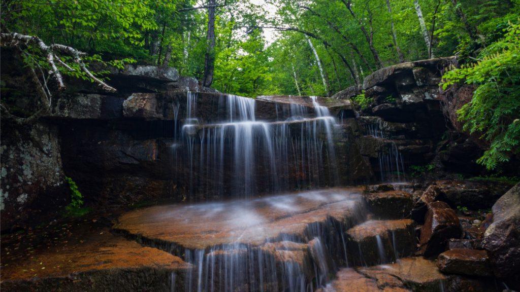
Sabbaday Falls
Sabbaday Falls is the most popular hike on the Kancamagus Highway — and for good reason. It’s a well-traversed, mostly flat 0.5-mile trail to the waterfall, and you can probably get there within a 15-minute walk.
This makes it an easy option for people with young kids or who are up for a short, easy walk through the woods.
Sabbaday Falls is a cascading, multi-level waterfall in a narrow flume. It empties into a placid green pool, but know that swimming is not allowed here. Platforms give you easy access to seeing the falls from multiple angles.
There are picnic tables and restrooms near the parking lot, making this a good place to stop for lunch.
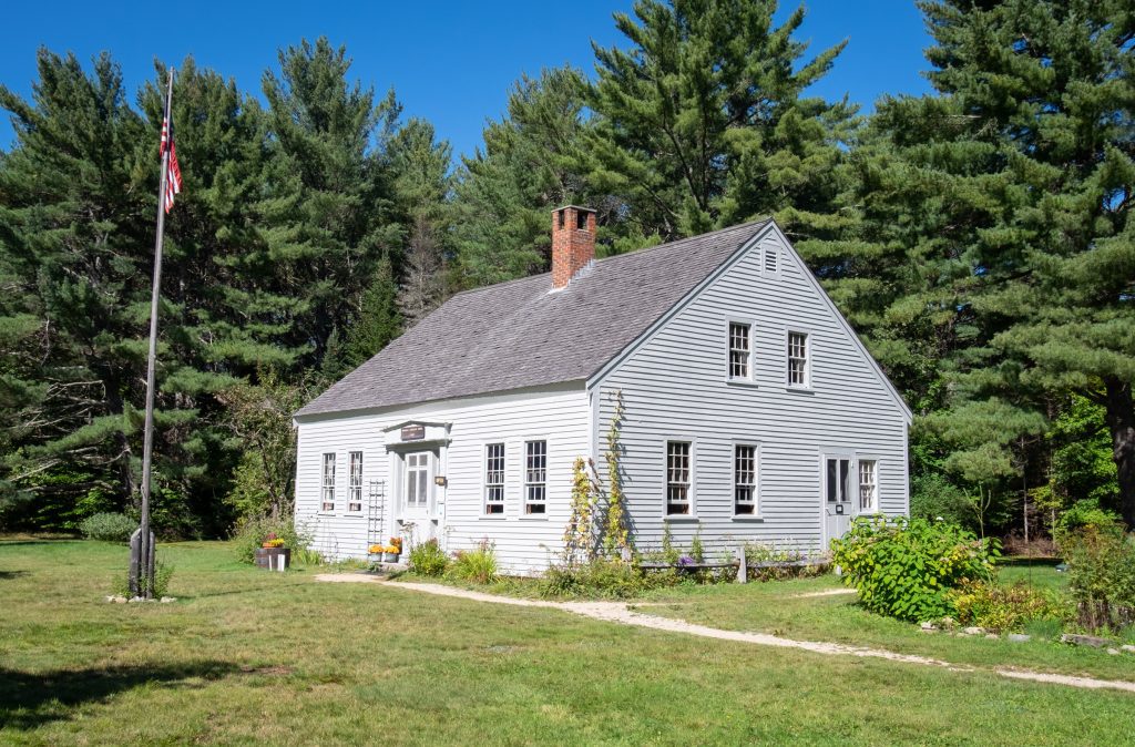
Russell-Colbath House
Soon you’ll reach the top historic spot on the Kanc: the Russell-Colbath House. We think that this is one of the best stops along the Kancamagus Highway, and if you get into conversation with Gary or any of the other local workers, you’ll be riveted by the story.
Russell-Colbath House was built in 1832 by Thomas Russell and his son Amzi, and today it’s on the National Register of Historic Places. Today the house is filled with historic artifacts.
The most scandalous story: in 1891, Amzi’s daughter Ruth lived in the house with her husband, Thomas Colbath. Thomas told Ruth he was going out for an errand. He never came back. For 39 years, Eliza lit a lantern in the house each night, awaiting his return, until her death. Three years later, Colbath came back to CLAIM THE HOUSE. Can you believe it?!
On the premises is an open-air barn, built in 2003 and filled with art and history displays. Behind the house is the Rail-n-River Trail, a paved and ADA accessible hiking path. It’s an easy hop back on to the Kancamagus national scenic byway.
Champney Falls
Another lovely waterfall hike is Champney Falls. If you enjoyed Sabbaday Falls but are up for more of a challenge, consider hiking to Champney Falls. The Champney Falls trail is 3.1 miles in and out, and more of a moderate-to-challenging hike.
Keep in mind that Champney Falls can be quite meager during dry times of year. You’ll see the heaviest flow during the spring months, but keep in mind that some of the streams can be impassible in times of rain. You’ll need to ford three streams along the way.
Want to continue? You can follow the signs directing you to the summit of Mount Chocorua.
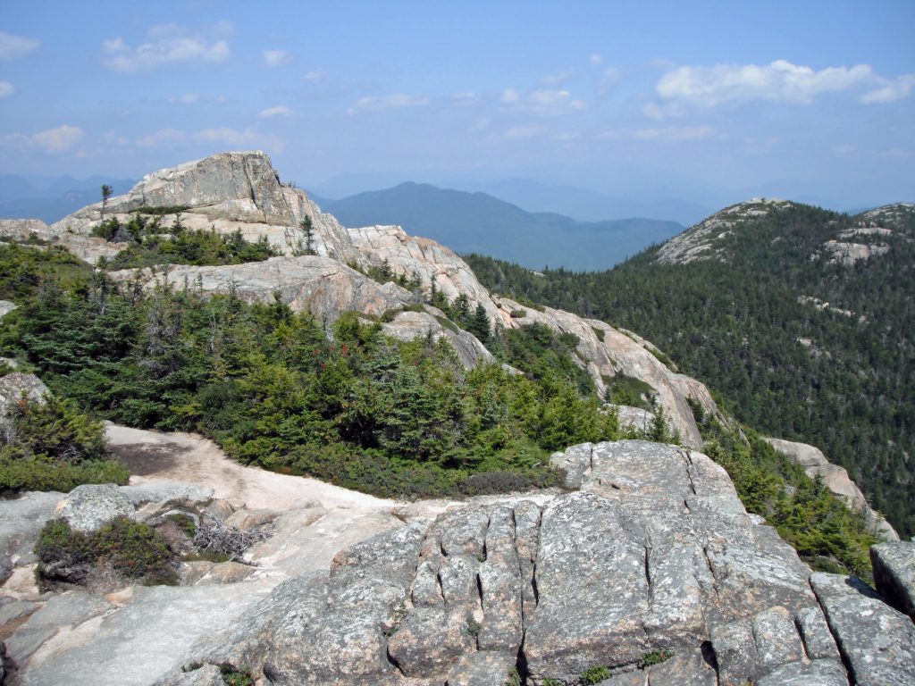
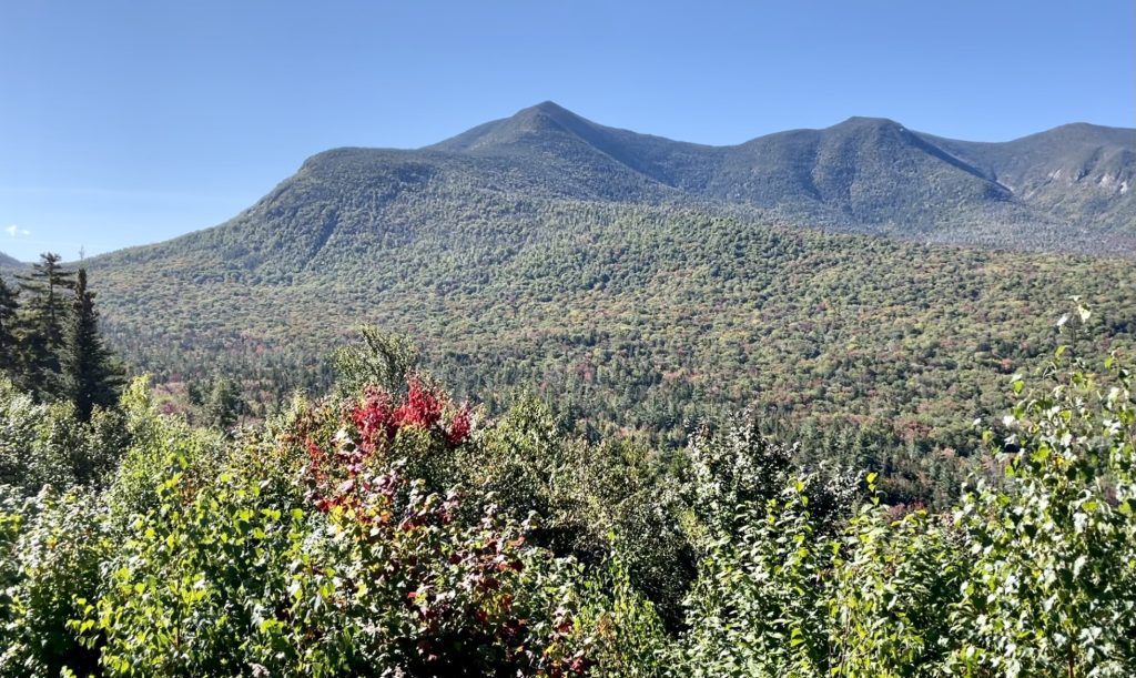
Mount Chocorua
Mount Chocorua (chuh-KOR-ah) technically isn’t along the Kancamagus Highway, but we’re including it because the trail to the summit is right off Champney Falls. In fact, once you get to Champney Falls, it’s just another 0.6 miles to the top.
From the Kancamagus Highway, it’s about a 3.8-mile journey (three hours return). If you’ve got the time for this, it’s incredibly rewarding, with 360-degree panoramic views across the White Mountains and Northern New Hampshire.
One nice thing about climbing Mount Chocorua is that it’s arguably the most visible peak in the White Mountains, its pointy top dominating the landscape. Every time you drive up Route 16, you’ll be reminded of your accomplishment!

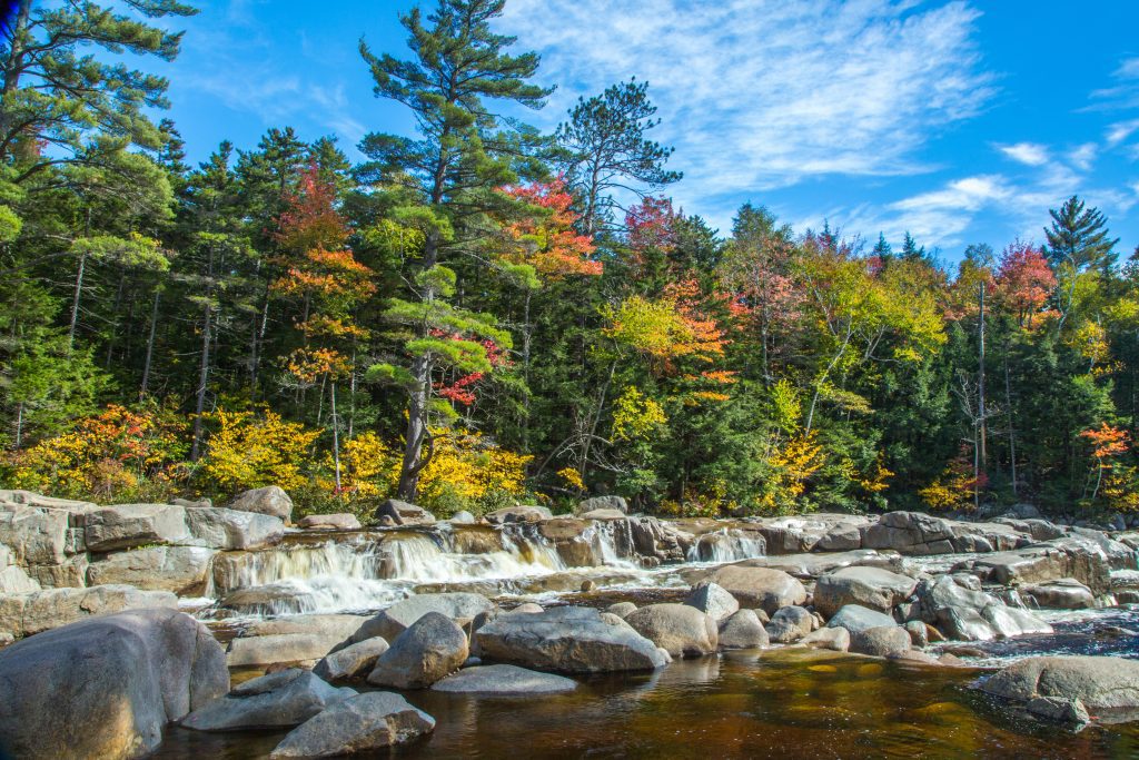
Rocky Gorge
Rocky Gorge Scenic Area is one of our favorite stops on the Kancamagus Highway. This area along the Swift River is filled with wide, flat stacks of rocks leading to a flush waterfall. A bridge across the river takes you to viewpoints that are excellent for photographing the falls. And there’s nothing like seeing it during foliage season!
Swimming is not permitted in Rocky Gorge. Trust us: we know the water looks inviting, but this is for your safety. The rocks here are incredibly slippery.
Rocky Gorge has restrooms and picnic tables set up, making it a good place to stop for a picnic along the way.
From Rocky Gorge, you can continue along the Falls Pond Trail to Falls Pond, which has another trail encircling the pond. It’s a one-mile out-and-back hike altogether.
Lower Falls
According to the White Mountain National Forest workers, Lower Falls is the most popular stop on the entire Kancamagus Trail. And it’s easy to see why — here the Swift River churns through waterfalls, pools, and swimming spots.
On a hot summer day in the White Mountains, there’s no better place to cool off than Lower Falls! Most of the pools are gentle and kid-friendly, but keep in mind that times of high water can be more dangerous.
There are restrooms and picnic tables here, as well as charcoal grills. Alcohol is prohibited.
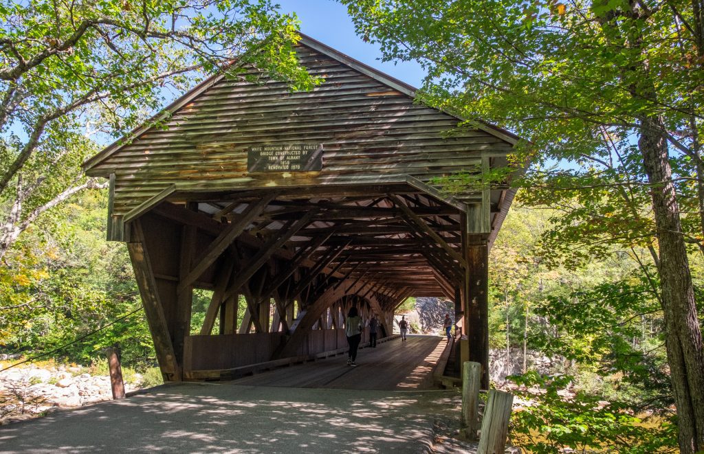
Albany Covered Bridge
Finally, we reach the Albany Covered Bridge, another historic site on the Kancamagus Highway. While New Hampshire is home to many covered bridges, this one is both historic and functional.
Originally constructed in 1857, destroyed in 1858, and rebuilt shortly after by Amzi Russell, the Albany Covered Bridge was further restored in 1970 and is still in operation today (though vehicles must be under 7’9″ and it’s only open to foot traffic during the winter).
The bridge is the only way to access Covered Bridge Campground — which keeps the giant RVs out!

How Much Time Do You Need on the Kancamagus Highway?
It all depends on how much hiking you’re going to do. Driving the Kancamagus Highway from end to end takes around 45 minutes, but if you hit up most of the stops, we think half a day, or three hours minimum, is a good amount of time.
For most travelers, we recommend stopping at each of the major stops listed above, including the short hike to Sabbaday Falls, but excluding the longer hikes along the Lincoln Woods Trail, Franconia Falls Trail, Champney Falls Trail, or Mount Chocorua.
If you want to add in any of the longer hikes, check out their length and duration and plan accordingly.
Keep in mind that you don’t need to do everything in a single day! If you’re staying in the Lincoln area, you can easily do Franconia Falls from there. Likewise with hiking Mount Chocorua from North Conway.

Kancamagus Highway Travel Tips
Fill up your tank before you get on the Kanc. There are no gas stations along the Kancamagus Highway, so be sure to fill up in Lincoln or Conway.
Get a GPS audio guide. This audio guide narrates based on your current location and tells you when to stop for cool sights, and it’s a great way to learn about the history and culture of the White Mountains.
Bring cash to pay for a parking pass. Parking in the White Mountain National Forest is $5 per day, and payment is by putting cash in an envelope at one of the parking lots along the highway. Only have a twenty-dollar bill? You’re paying for four days.
Otherwise, you can learn about annual passes and nationwide passes here.
Don’t be a bad Instagrammer. Do not stand in the middle of the road to take your perfect picture — you’re endangering yourself and other people.
Dogs are welcome on White Mountain National Forest hiking trails, but they must be leashed. Your furry friend will love it here!
Don’t swim where swimming is not allowed. This is for a reason. Once at Rocky Gorge, we saw a couple swimming despite the NO SWIMMING signs — and the woman stood up and fell forward, smacking hard onto the rocks.
Bring a picnic. There are no food stops along the Kancamagus Highway, but there are plenty of picnic spots! We recommend Sabbaday Falls, Rocky Gorge, and Otter Rocks for picnic table access; otherwise, bring a blanket to set down.
Finish your day with a hearty meal and perhaps a craft beer. Two of our favorite brewery restaurants are close to the ends of the Kanc: Moat Mountain Smokehouse and Brewery in North Conway and Woodstock Inn Brewery in North Woodstock. Both have excellent nachos, chili, barbecue, and craft beers.
Read More:
Best Restaurants in North Conway, NH
The Best New Hampshire Breweries

Where to Stay on the Kancamagus Highway
There are no hotels along the Kancamagus Highway, which is why most people choose to stay overnight in Lincoln or North Conway. Otherwise, your only option is to camp.
Kancamagus Highway Campgrounds
Here are the campgrounds of the Kanc, listed from west to east:
- Hancock Campground in Lincoln, NH
- Big Rock Campground in Lincoln, NH
- Passaconaway Campground in Albany, NH
- Jigger Johnson Campground in Albany, NH
- Blackberry Crossing Campground in Albany, NH
- Covered Bridge Campground in Albany, NH
Backcountry camping is another option in the White Mountain National Forest, but there are lots of rules in place. Consult the White Mountain National Forest Backcountry Camping Guide before you camp here.
Where to Stay in North Conway, NH
North Conway is one of our favorite towns in the White Mountains, with an adorable village-like atmosphere and easy access to the great outdoors. It’s a great base for driving the Mount Washington Auto Road, wading in the pools at Diana’s Baths, or skiing at Cranmore Mountain.
- Special splurge: Cranmore Inn
- Great value for money: Kearsarge Inn
- Family-friendly: Comfort Inn & Suites North Conway
2024 Note: A previous version of this post recommended Red Jacket Mountain View Hotel but it has closed indefinitely, due to a fire.
Our Full Guide: Best North Conway Hotels and B&Bs
Where to Stay in Lincoln, NH
Lincoln isn’t as pretty as North Conway, but it makes a great base for the most striking parts of the White Mountains. You’ll have easy access to Franconia Notch State Park and attractions like the Flume Gorge, Lost River Gorge and River Caves, and Cannon Mountain.
- Special splurge: Riverwalk Resort at Loon Mountain
- Great value for money: Riverbank Motel and Cabins
- Family-friendly: InnSeason Resorts Pollard Brook
Our Full Guide: Best Lincoln, NH Hotels and B&Bs

Is the Kancamagus Highway Worth It?
Absolutely! The Kancamagus Highway is SO worth it. We think this is an incredibly beautiful drive, one of the best things to do in New Hampshire, and one of the absolute best places to view fall foliage in the United States.
We hope you love the Kancamagus Highway as much as we do!
More on the White Mountains:
- 27 Epic Things to Do in Lincoln, NH
- A Guide to the Mount Washington Cog Railway
- Hiking the Appalachian Trail in New Hampshire
- Snow and Ice Climbing in the White Mountains, NH
- 31 Fun Things to Do in North Conway
- 12 Best Restaurants in North Conway
- 50+ Best Things to Do in New Hampshire
- Tips for Visiting Glen Ellis Falls
- Riding The Conway Scenic Railroad
- Tips for Driving The Mount Washington Auto Road
- 23 Fun Things To Do In Littleton, NH
- 16 Best Things To Do in Jackson, NH
- 30 Unforgettable Things To Do In The White Mountains, NH
Best of New Hampshire:
- 50+ Best Things to Do in New Hampshire
- Best Beaches in New Hampshire
- Best New Hampshire Breweries
- New Hampshire Fall Foliage: When and Where To Go
- 30 Unforgettable Things To Do In The White Mountains, NH
Have you driven the Kancamagus Highway? Any tips to share?
Is this highway safe for big Rv’s to drive on?
Absolutely, big RVs are often seen on the Kancamagus.